Bay Area Boosts Wildfire Defence with AI and NASA's Cutting-Edge Ember Risk Mapping
Bay Area Steps Up Wildfire Prevention with Advanced Technology
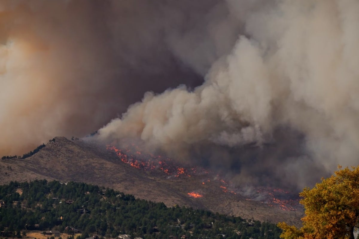
The Bay Area is taking a significant leap forward in its fight against devastating wildfires, leveraging the power of artificial intelligence (AI) and a revolutionary ember-risk map developed by NASA. As California continues to face increasingly severe fire seasons, this proactive approach aims to drastically improve early detection and prevention efforts, protecting communities and valuable ecosystems.
AI Sensors: A New Layer of Early Warning
Traditionally, wildfire detection has relied on human observation and satellite imagery. However, these methods can be slow and often miss the crucial early stages of a fire. To address this, the Bay Area is deploying a network of AI-powered sensors. These sensors, strategically placed throughout high-risk zones, are capable of identifying subtle indicators of fire ignition, such as changes in temperature, smoke particles, and even unusual sound patterns. The AI algorithms learn to distinguish between normal environmental factors and potential fire threats, reducing false alarms and ensuring swift responses.
NASA's Ember-Risk Map: Pinpointing Vulnerability
Beyond detection, understanding where fires are *most likely* to start is equally critical. This is where NASA's innovative ember-risk map comes into play. This map doesn't just show where fires *have* occurred; it predicts areas most vulnerable to ignition from embers – the tiny, wind-blown fragments of burning material that can travel long distances and spark new fires far from the original blaze.
The map incorporates a wealth of data, including:
- Vegetation Type: Different plants burn at different intensities and produce varying amounts of embers.
- Wind Patterns: Wind direction and speed directly impact ember dispersal.
- Topography: Slope and terrain influence fire behavior and ember travel.
- Fuel Moisture: The dryness of vegetation is a key factor in ignition risk.
By overlaying this data, the map highlights areas with a high probability of ember-caused ignitions, allowing fire agencies to prioritize prevention efforts like brush clearing and community education.
A Combined Approach for Enhanced Protection
The real power of this initiative lies in the synergy between the AI sensors and the ember-risk map. The sensors provide real-time detection data, while the map provides a strategic understanding of vulnerability. This combined approach allows fire agencies to:
- Deploy resources more effectively: Focusing on high-risk areas identified by the map.
- Implement targeted prevention measures: Clearing brush and educating residents in vulnerable zones.
- Respond faster to potential ignitions: AI sensors provide early warnings, allowing for rapid deployment of fire crews.
Looking Ahead: A Model for Future Fire Management
The Bay Area's innovative use of AI and NASA’s ember-risk map represents a significant advancement in wildfire management. This approach, combining cutting-edge technology with data-driven decision making, offers a promising model for other regions facing similar challenges. As climate change continues to exacerbate wildfire risk across Australia and globally, these types of proactive and technologically advanced strategies will be increasingly crucial for protecting communities and preserving our natural landscapes. The hope is that this collaboration will help minimise the devastation caused by wildfires, ensuring a safer future for all.